
A newly released image from a Mars satellite offers a glimpse into the complex past of the now dry and dusty world.
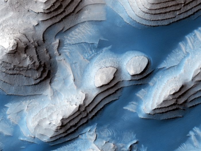
From high above the surface of Mars, the orbiting High Resolution Imaging Experiment (HiRISE) homes in on the Danielson Crater, just north of the Mars equator. This region is intensely interesting to space geologists because of the layered sediments that line the crater.
Layered deposits can be found all over Mars, but the Danielson Crater contains some of the most spectacular and best preserved. Even more fascinatingly, they appear to be evenly spaced, with different levels of erosions: stronger layers forming steps, with layers of weaker material within them.
The evenness of these layers means they cannot have been created by random processes, such as impact events. Rather, scientists think that a regular, repeated process deposited the layers.
 A HiRISE image of the crater released in 2012. (NASA/JPL-Caltech/UArizona)
“The rock was formed millions or billions of years ago when loose sediments settled into the crater, one layer at a time, and were later cemented in place,” a NASA blog post explained in 2019.
“Cyclical variations in the sediment properties made some layers more resistant to erosion than others. After eons, these tougher layers protrude outward like stair steps. Across these steps, the winds have scattered sand (typically appearing darker and less red, i.e. ‘bluer’ in contrast-enhanced color), giving rise to the zebra stripe-like patterns.”
On the small scale, there are large regions of rock that are heavily fractured. Scientists have studied these fractures and determined that, since the pieces fit together perfectly, this occurred after the deposits had already turned to rock.
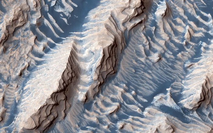 Image of the crater released in 2019. (NASA/JPL-Caltech/UArizona)
It’s unclear exactly how the deposits formed, but the deposits could have been made on annual timescales, or even longer.
Some scientists have suggested that the periodic process could have been the result of climate change associated with Mars’s orbital variations. Another study suggests that groundwater upwelling might be responsible.
There are so many cool Mars rocks planetary geologists would love to get an in-person look at. Meanwhile, orbiters with amazing cameras, like HiRISE, are helping reveal Mars’s fascinating history.
You can download the above image in high resolution from the HiRISE Flickr page.